| Location | Mount Jewett | Trail Type | Out & Back |
| Distance | 0.4 miles | Foot Traffic | Light to medium |
| Difficulty | Moderate | Elev. Gain | 311 feet |
| Recommended for | Beginners, Family Fun |
The Kinzua Creek Trail is less of a hike than a short climb along a steep, gravel hill, but the sights along the trail are definitely worth the effort. The Kinzua Viaduct was once the highest and longest railway bridge in the world at 301-feet high and 2,053-feet long. It was rebuilt in 1900 to haul coal and later offered recreational excursions through the Allegheny National Forest.
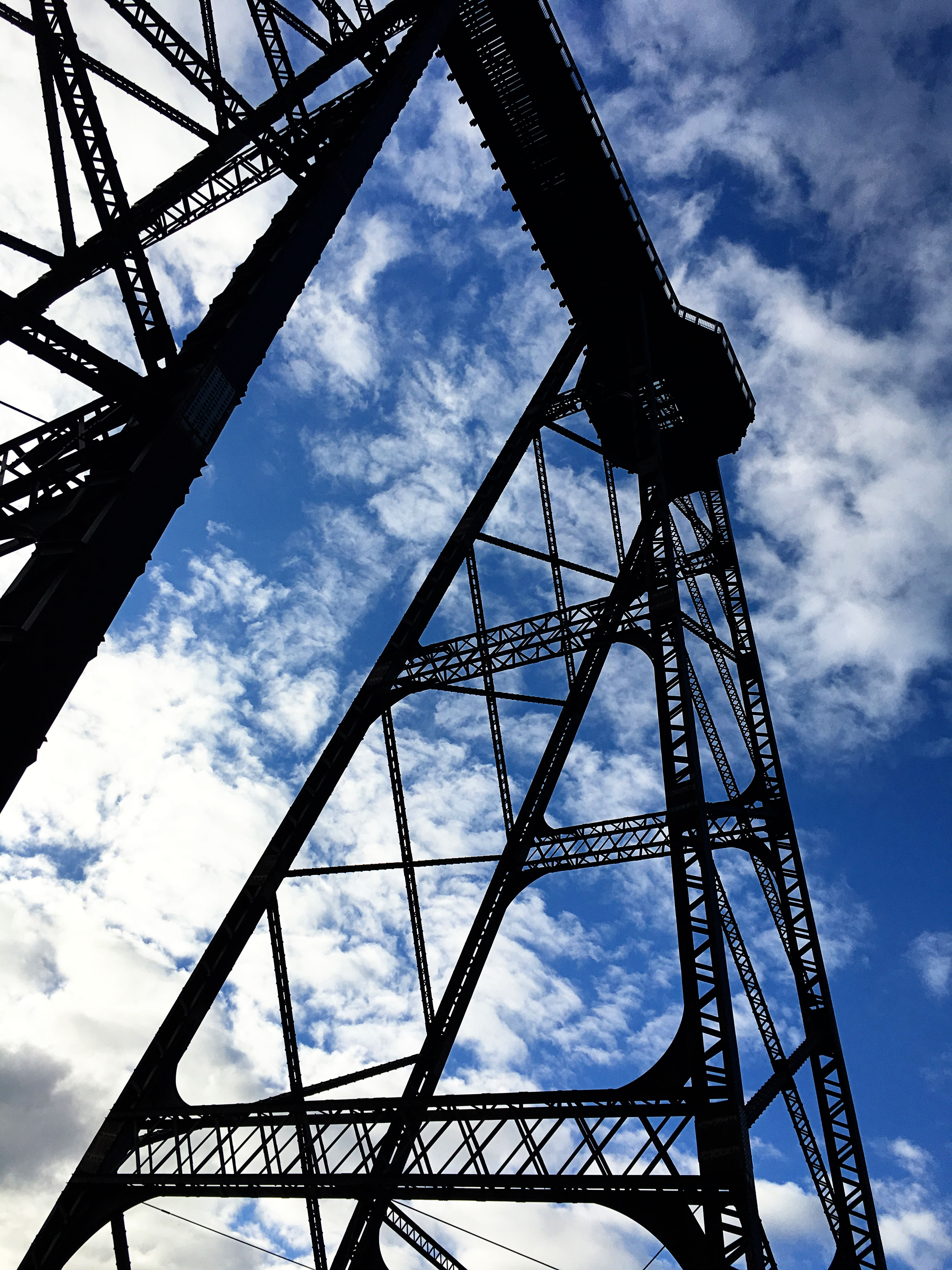
In 2003 an F1 tornado, with wind speeds between 73 and 112 miles per hour, ripped through the gorge, uprooting hundreds of trees and destroying 11 of the bridge’s 20 towers. This trail lets you get up close and personal with the giant, twisted, steel remains of the bridge, and the nearby skywalk lets you observe the damage from high above the valley floor’s canopy.
The Skywalk
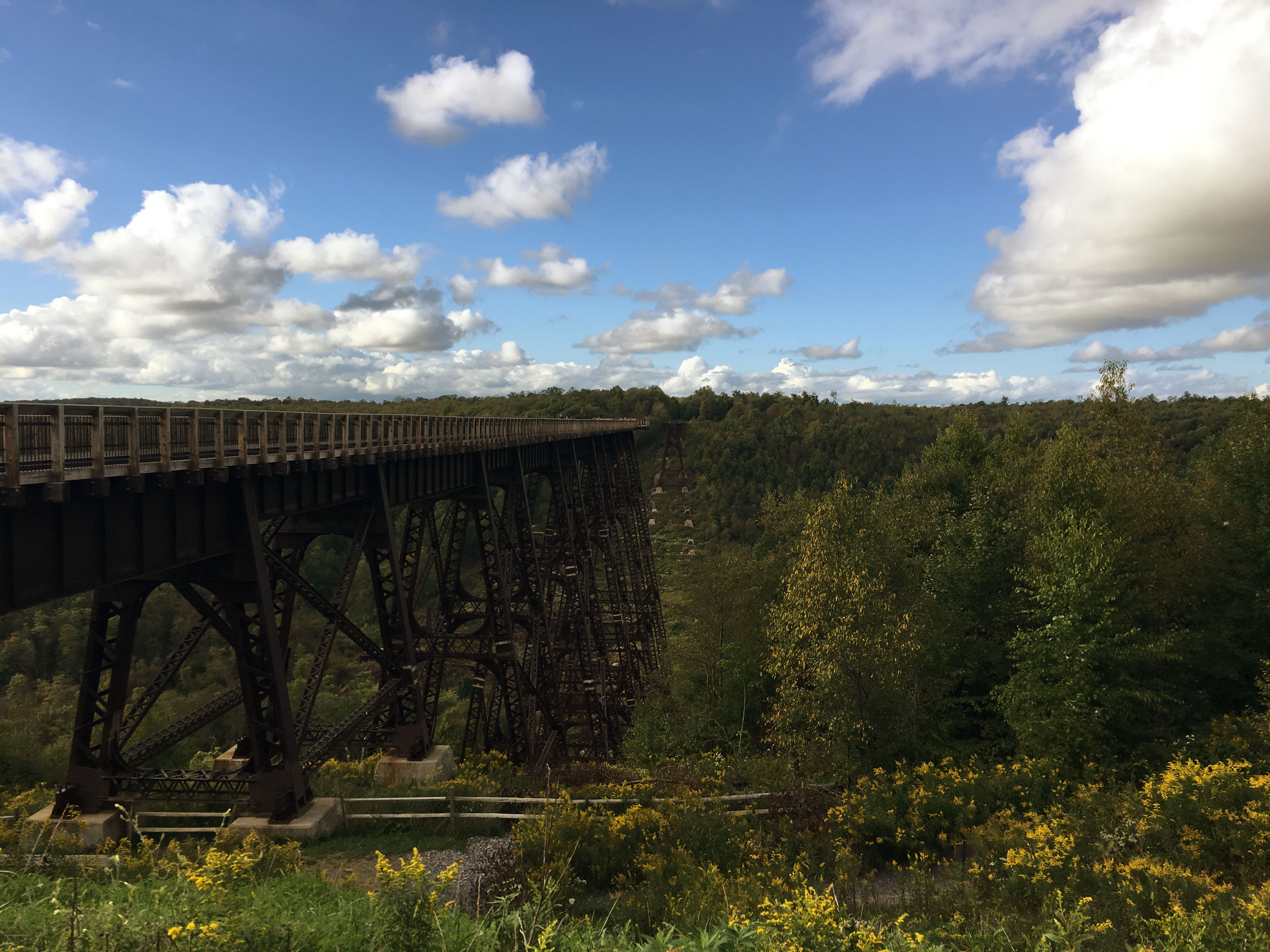
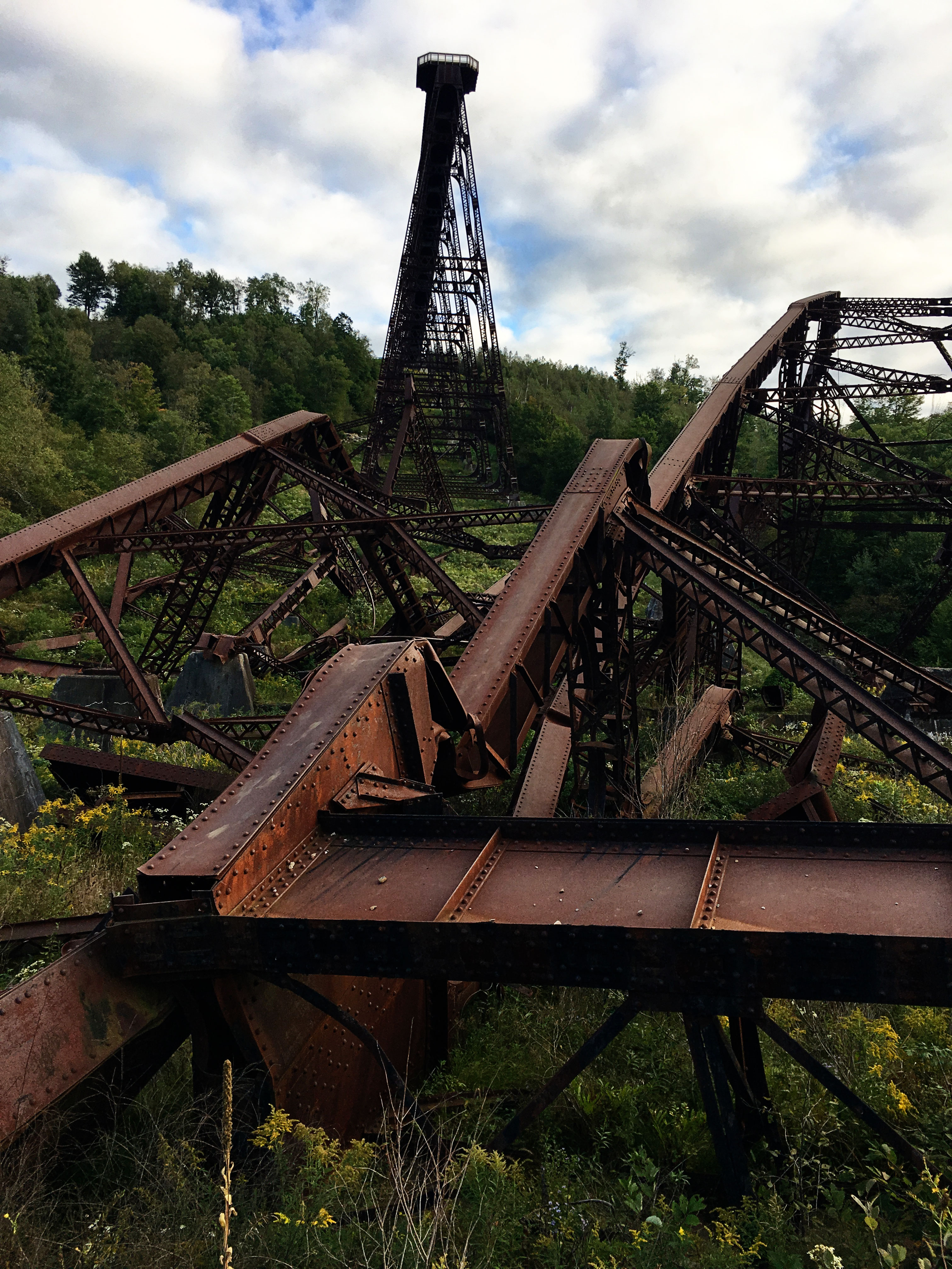
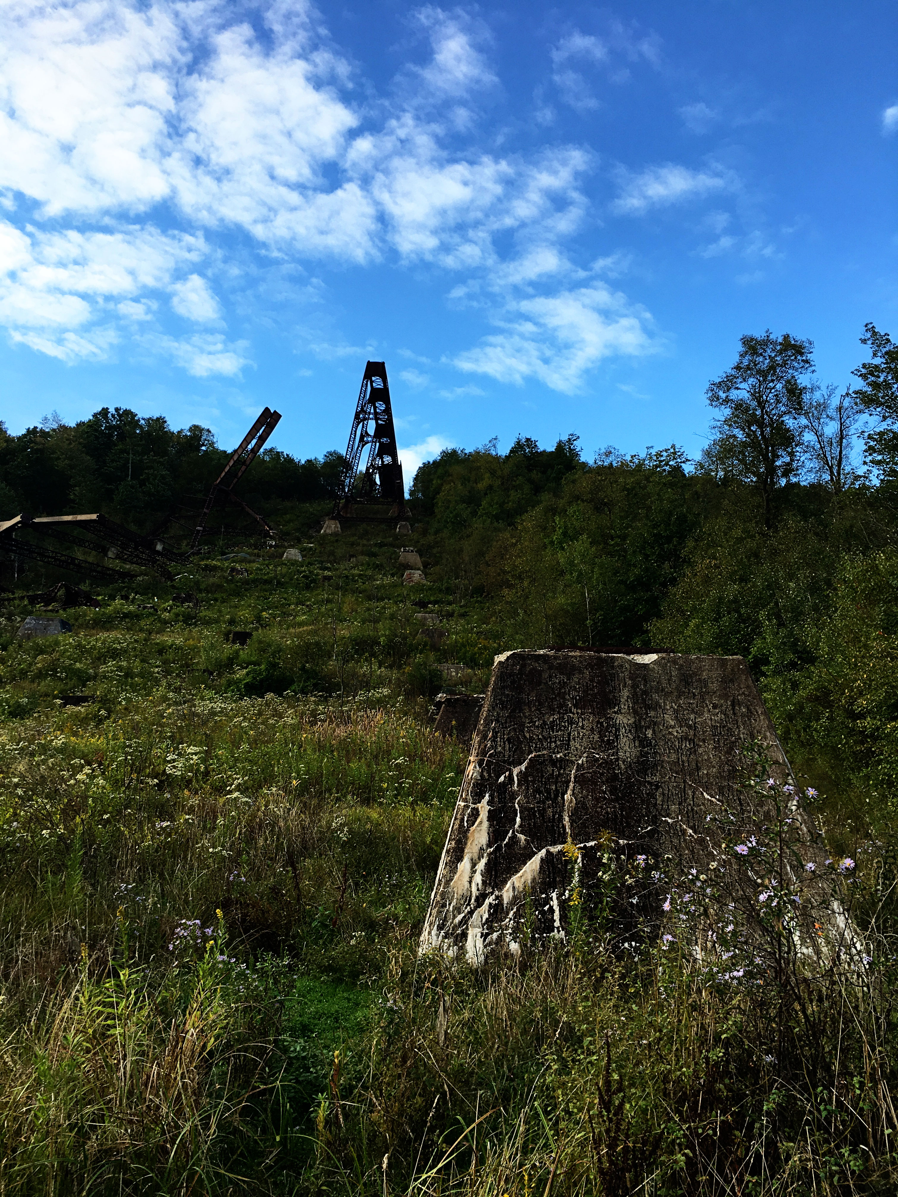
What remains of the bridge are two standing sections separated by the Kinzua Creek and the twisted remains of the 11 towers destroyed by the tornado. Six of the Viaduct’s remaining towers were restored and transformed into a 600-foot-long pedestrian skywalk.
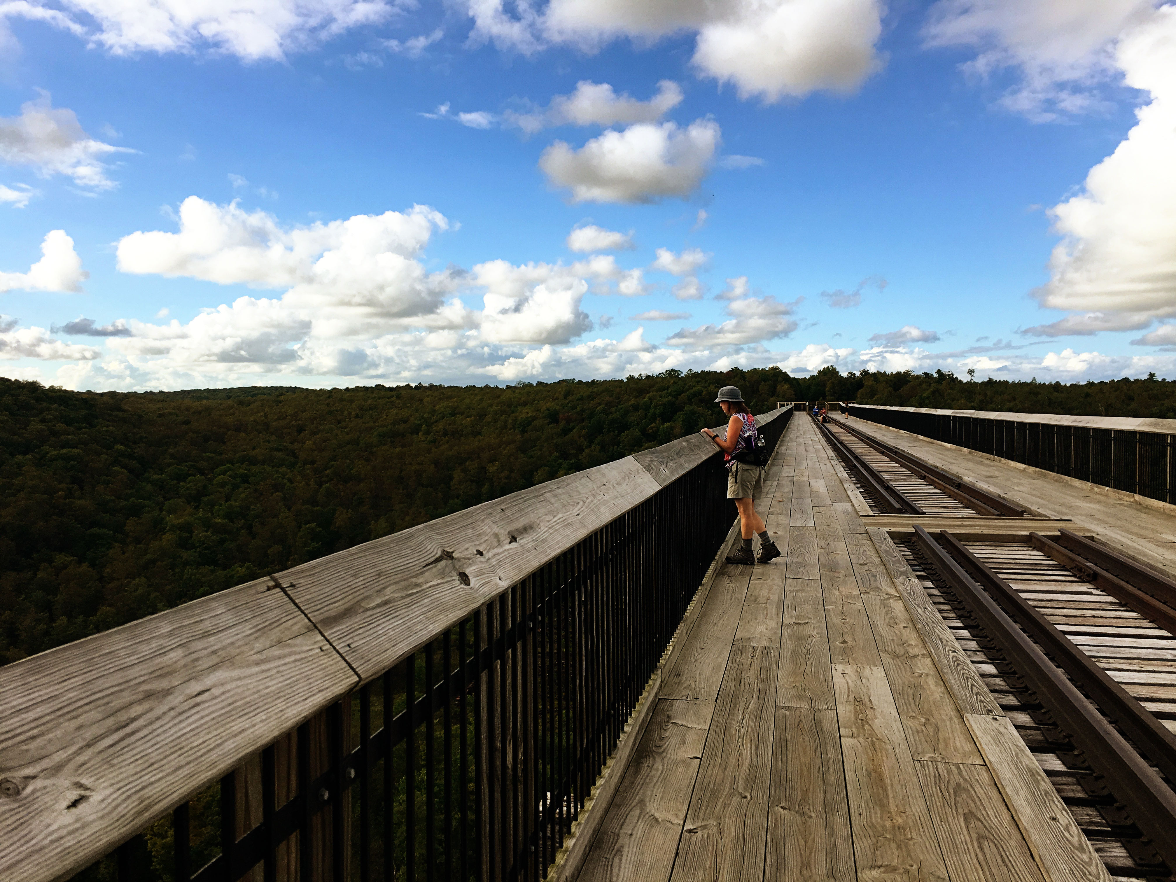
The skywalk is wide and wooden, with rails in the center and two spacious walking sections on either side. At the end is an observation deck with a partial glass floor, so you get spectacular views of both the bridge’s undercarriage as well as the destruction in the debris field below. I visited Kinzua Bridge State Park in September, too early to enjoy the fall foliage, but if you visit in October, I’m sure you’ll be treated to a beautiful mix of yellow and orange trees as far as your eyes can see.
The skywalk is open every day from 8 a.m. until dusk. Admission and parking are free, but the skywalk does close when weather conditions are unsafe due to wind, frost, or ice. Contact the park before your visit and ask about current conditions.
The Trail
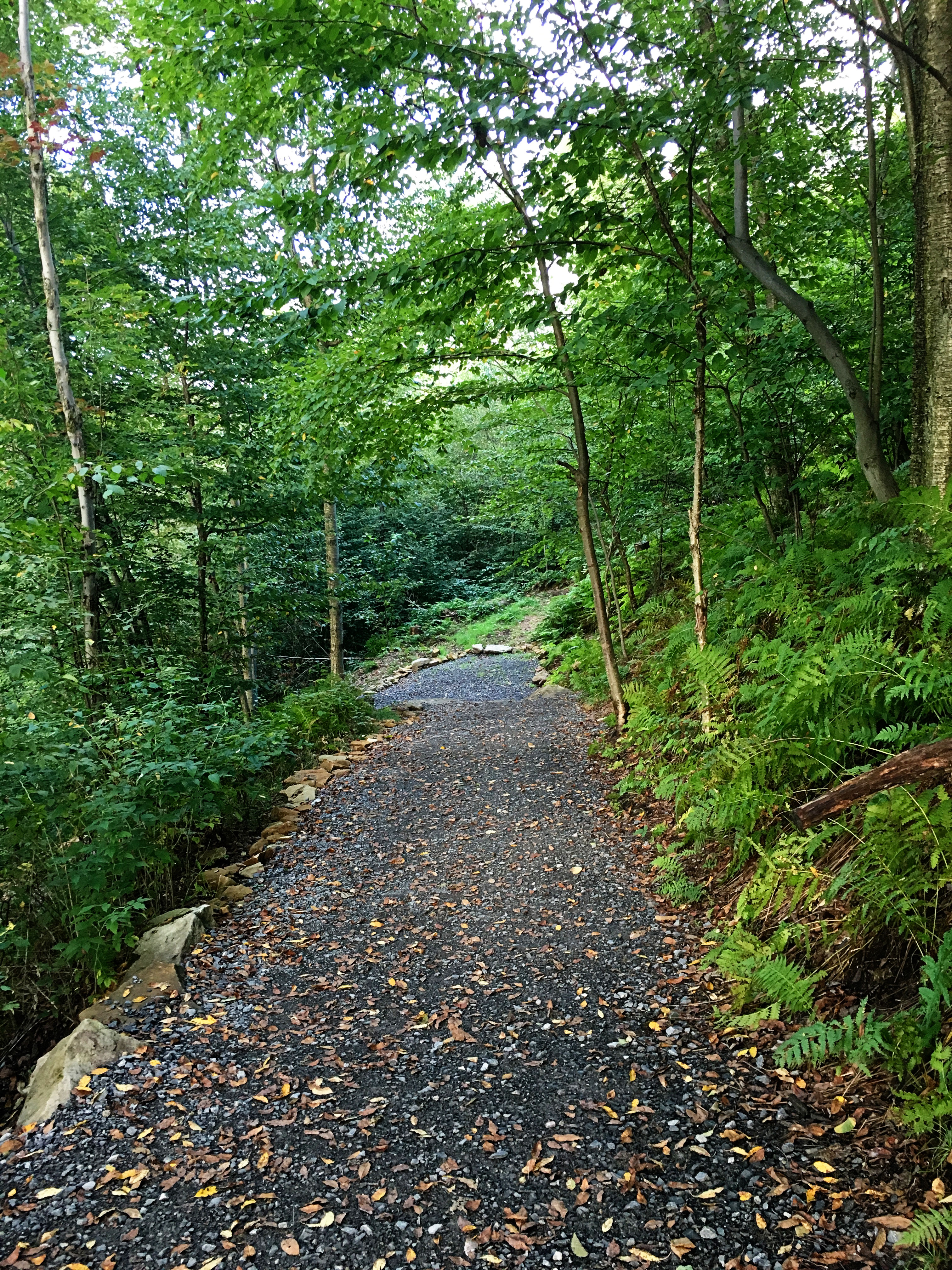
This thing is deceptive. Getting to the bottom of the gorge is fairly easy — the first portion of the trail is made up of wide, gravel switchback paths, lined with benches and with a few spots to stop for photos. There aren’t any blazes to follow, but they really aren’t needed.
Don’t be fooled! Because this is an out-and-back trail, you’ll be returning to the top of the gorge via those same switchbacks, which can be brutal on the return trip, depending on how conditioned you are. If you have small children or any breathing difficulties, be prepared for frequent stops. Use those benches often and take your time.
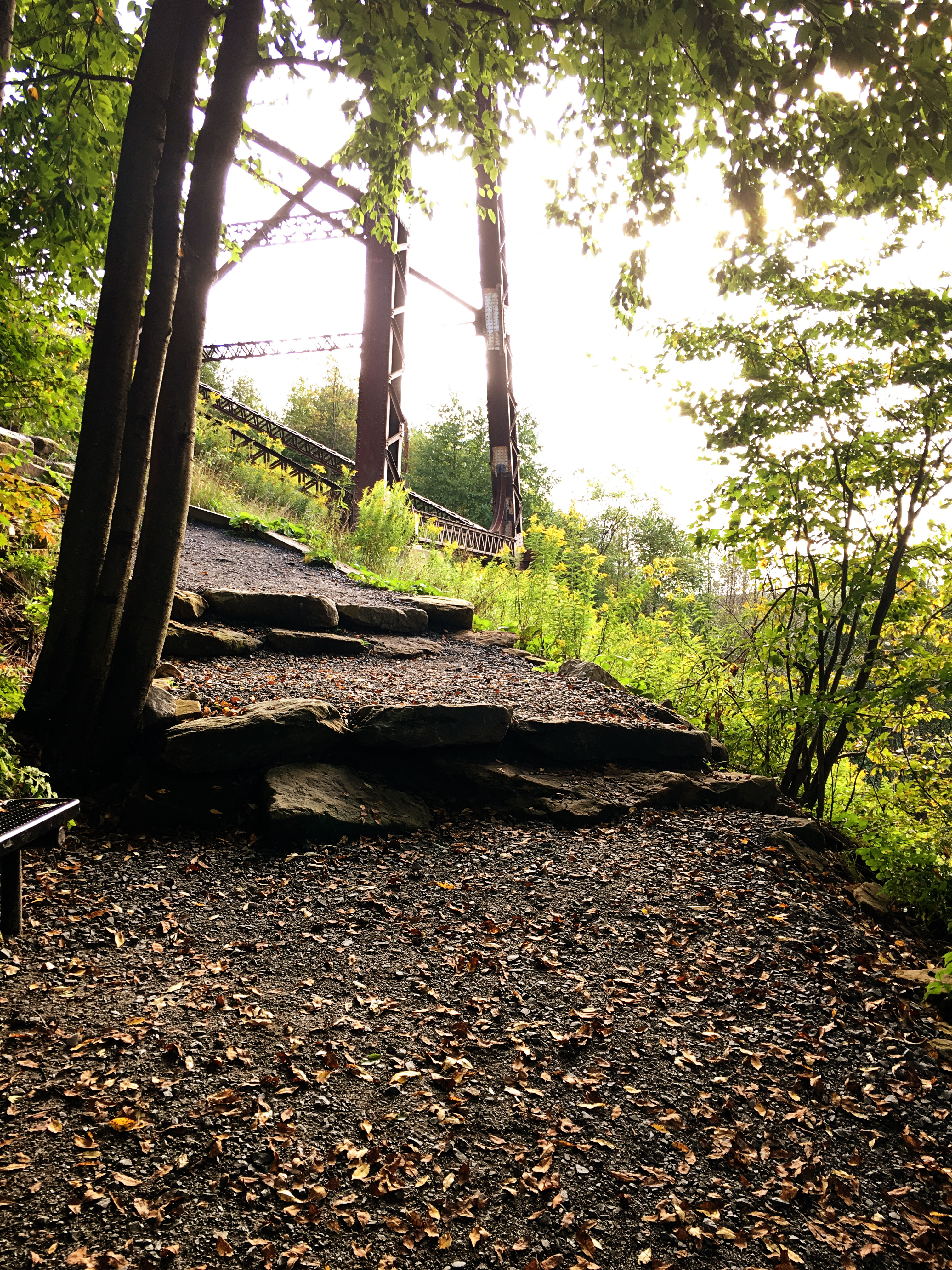
The trail will lead you to two scenic overlook platforms for photos — the first is near the trailhead, and the second is underneath the skywalk and gives an incredible view of the steel structure under the bridge.
Once you reach the valley floor, the path is more narrow, and during the summer and early fall, everything is overgrown, which can make it hard to follow the right path. Look for the wooden planks among the tall grasses; they’ll help guide your way if you’re unsure.

On the other side of the valley field is another gravel path, which leads to the footbridge over the Kinzua Creek. 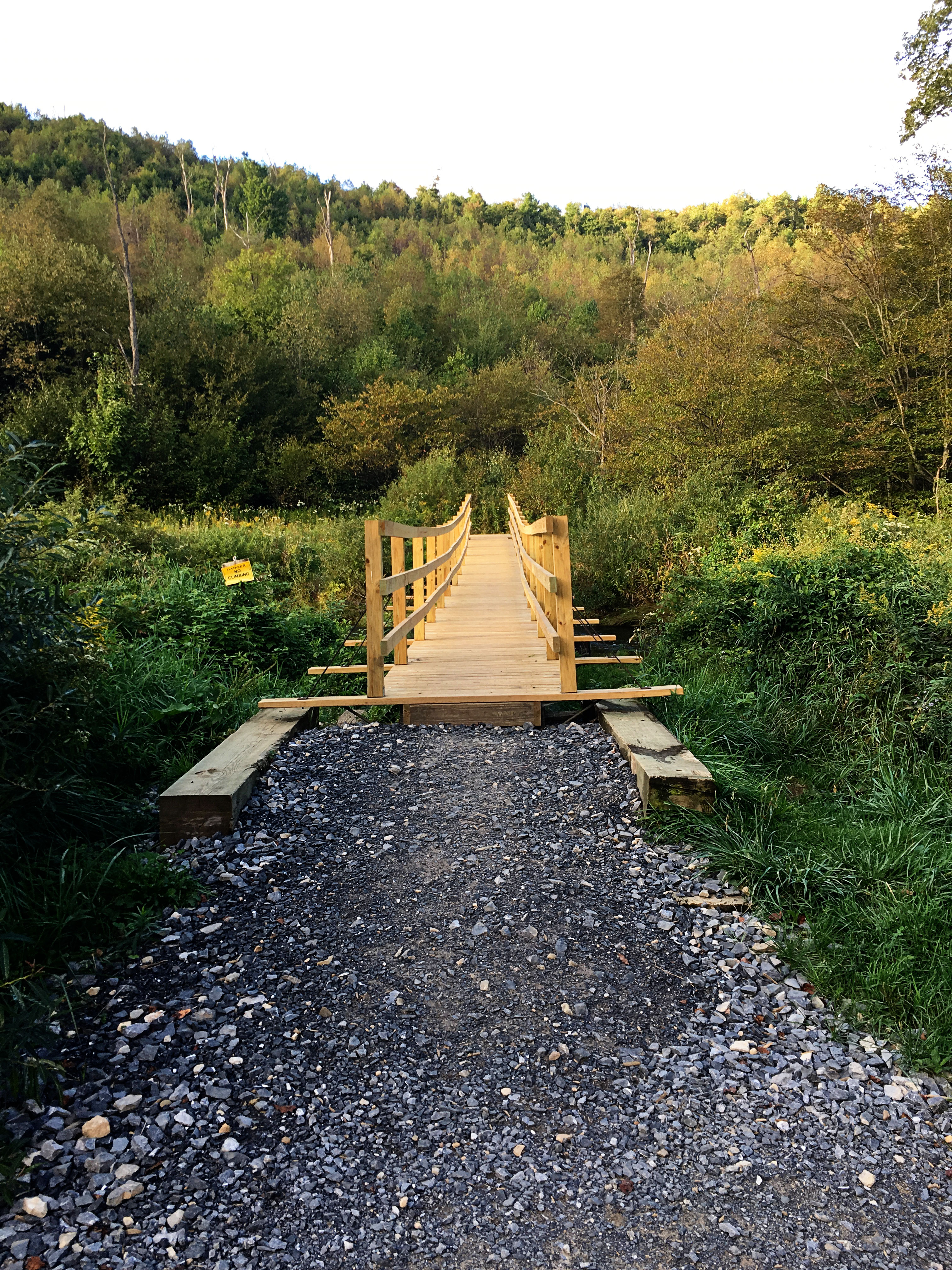
At this point, be sure to turn around and see how far you’ve come. The skybridge looming above the valley floor is an incredible sight.
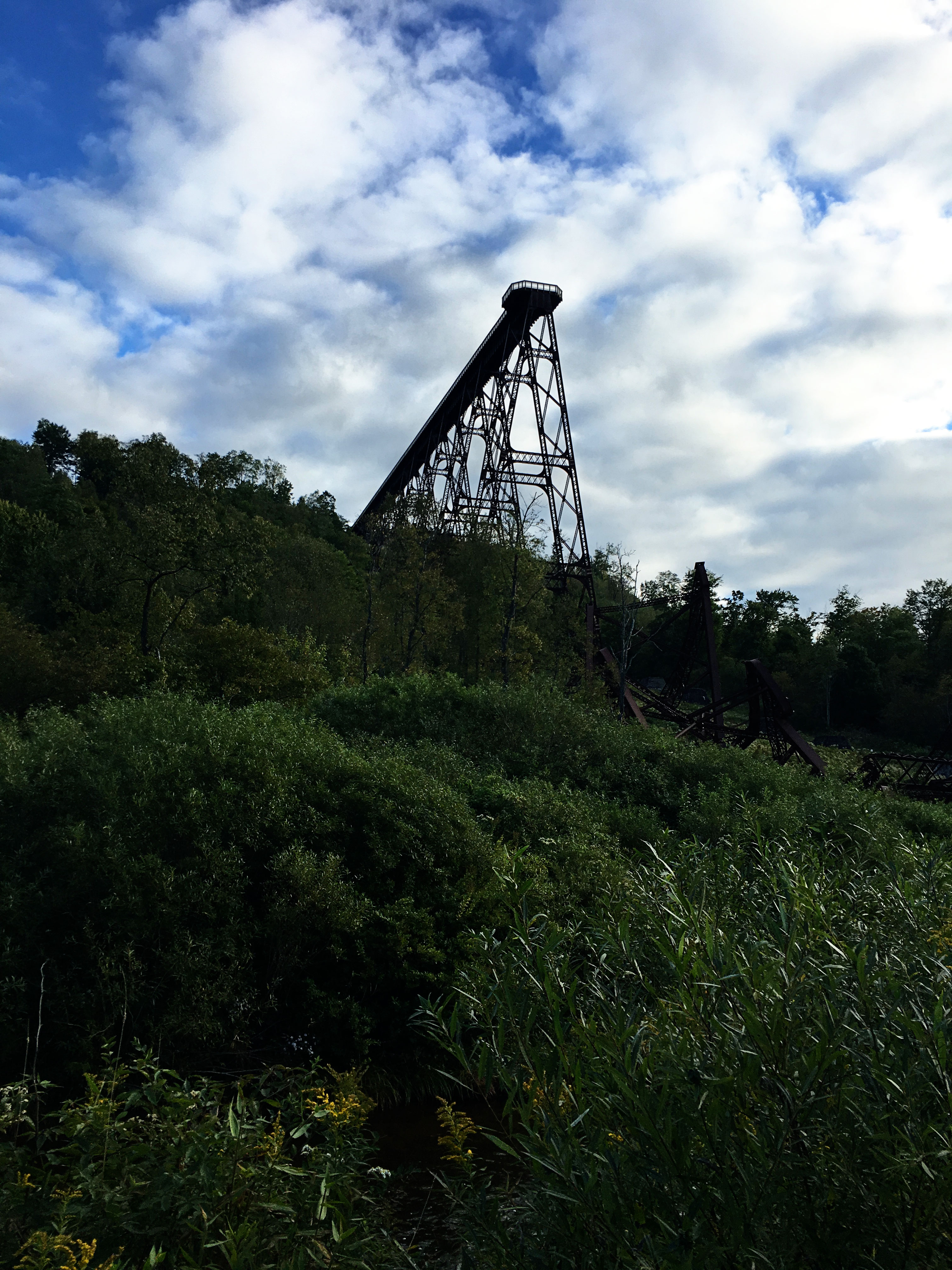
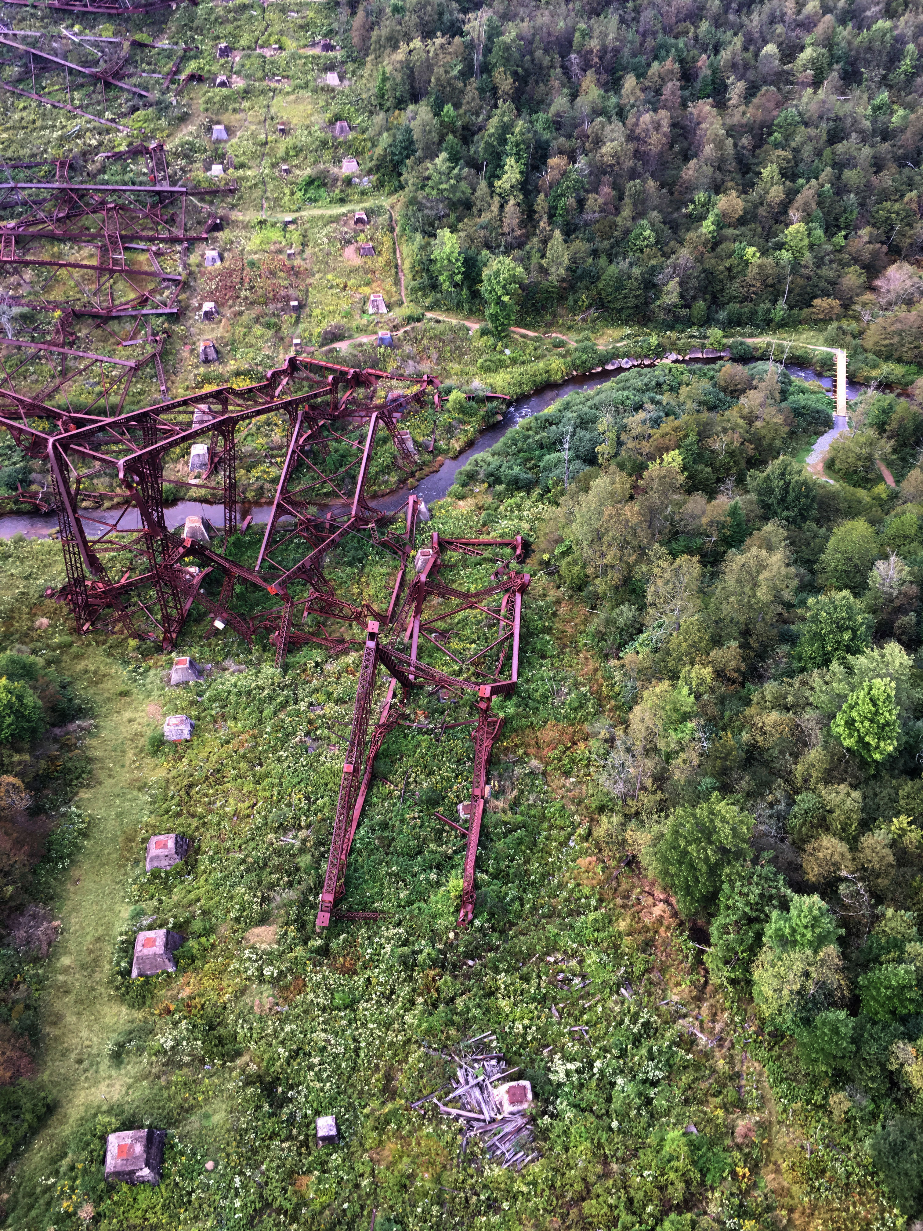
Cemetery of Steel
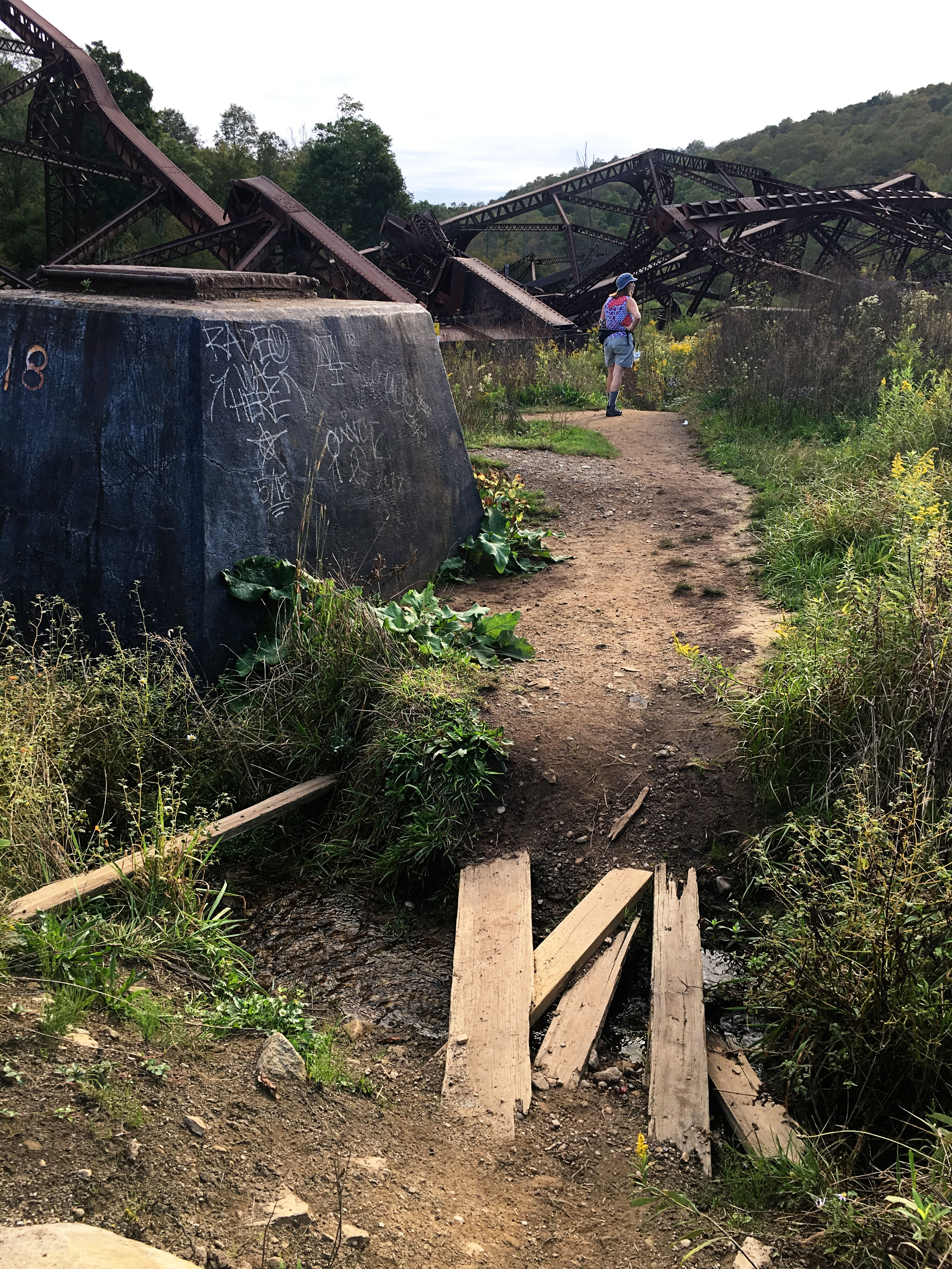
The trail turns into a dirt path on the other side of the Creek and meanders around the outskirts of the debris field, giving close-up views of the massive steel supports that once held the Viaduct.
Visitors are prohibited from entering the debris field itself for their own safety. Please respect the signage and stick to the path. The structures here are unstable and these rules are there for your own safety.
Admissions & Fees
Admission and parking for the park, visitor’s center, and Skywalk are all free. You can visit the Allegheny National Forest Visitors Bureau online to request or download a free brochure to learn more about Kinzua Bridge State Park before your trip.
Directions & Parking
Kinzua Bridge State Park is 4 miles north of Mount Jewett via U.S. Route 6.
Address — 296 Viaduct Road, Mount Jewett 16740 (41.75953, -78.58702)
You can go directly from the enormous parking lot to the trail and bypass the Visitor’s Center entirely, but that would be a travesty. The two-level Center is filled with educational and interactive exhibits and movies about the Viaduct’s history, it’s tragic end, and the local wildlife and fauna. There is ample paved parking in front of the Center, as well as a secondary, gravel lot and paved RV/bus parking. Across from the Center is an ADA-accessible pavilion, which can be reserved for events, and the surrounding area has picnic tables.
Nearby Trails
- General Kane Trail (1.6 miles) — loop, easy
- Kinzua Valley Trail (7 miles) — out-and-back, moderate
- White Pine Trail (3 miles) — loop, moderate
- Bullis Hollow Trail (8.3 miles) — outage-and back, moderate to difficult
- North Country National Scenic Trail (96.6 miles in the Allegheny National Forest) – out-and-back, difficult

One thought