| Location | East Earl | Trail Type | Loop |
| Distance | 2.4 miles | Foot Traffic | Light |
| Difficulty | Easy | Elev. Gain | 131 feet |
| Recommended for | Beginners, Family Fun |
#RealTalk: The Welsh Mountain Trail doesn’t offer the sexiest views in the state. There aren’t any technically challenging rock scrambles or character-building switchbacks to climb. But it is a versatile loop trail with a choose-your-own-adventure type of vibe. I consider it to be a pleasant, practical trail that’s worth a visit if you want to try out new gear or introduce kids or beginners to hiking.
Personally, I’ve used it to break in new boots, train after an ankle injury, and teach my daughter how to read blazes. There are so many connecting trails that it’s quick and easy to get back to the parking lot if you don’t have much time to spend outdoors, or if you think your new hiking boots are fine, but then after a mile and a half they give you such bad blisters that you need to finish your hike in your socks…. You know, hypothetically.
The Trail

The sign at the trailhead recommends hiking the Welsh Mountain Trail counterclockwise, and I typically oblige because I like reaching the Overlook Trail — an easy half-mile, out-and-back side trail — toward the end of my trip. If you use AllTrails, be aware that the default map and elevation guide follow the trail in a clockwise hike.
The Overlook borders Money Rocks County Park, so named because during Prohibition, local grain distillers used to stash their money among the rocks. It’s not Pinnacle or Pulpit Rock, but in the winter, when the trees are bare, it provides a peaceful view of the Pennsylvania farmlands below.
Follow the blue-blazed Welsh Mountain Trail from the trailhead and make a right at the nearby split for the counter-clockwise experience. Regardless of which way you end up taking, the trail is clearly marked with practically no elevation gain. Easy-peasy for even the littlest or newest hikers.
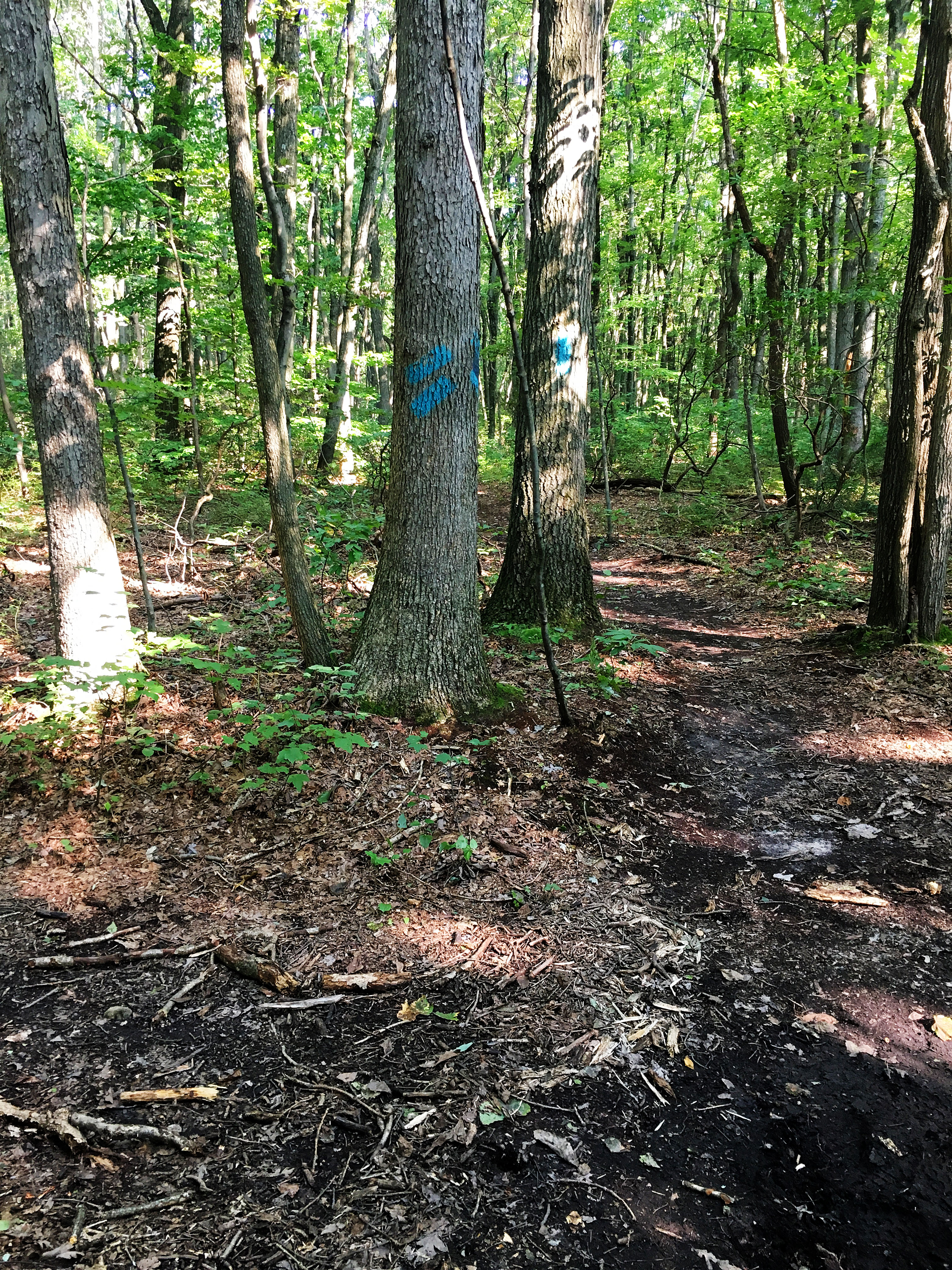
At about 0.1 mile on the trail, you’ll cross the first intersection for the Green Connector, a 2.2-mile, green-blazed trail that leads northeast to the adjacent Money Rocks Park. At around the 1.5-mile mark, the trail will intersect with the Green Connector again.
Shortly after that (at about 1.6 miles) the trail crosses the Orange Connector, a 1.2 mile, (you guessed it) orange-blazed trail that leads northeast to the Cockscomb Loop and ends at the Money Rocks Overlook (not to be confused with the Overlook on the blue-blazed Welsh Mountain Trail).
See what I mean about this being a choose-your-own-adventure type of trail? By using the Connector Trails you can make this trip as long or short as you want — either using them to leave Welsh Mountain Nature Preserve altogether or to high-tail it back to your car if you need to cut your hike short.
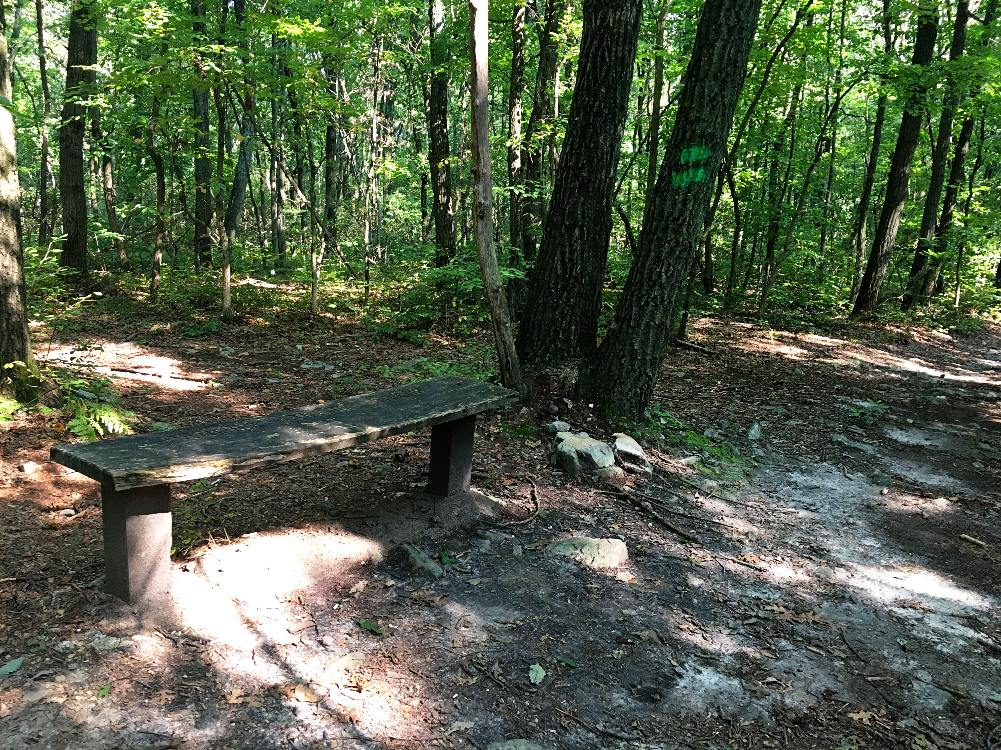
Second intersection between the Welsh Mountain Trail and Green Connector (around mile 1.7).
Good spot to stop for a snack, if traveling with young ones.
If you continue following those blue blazes, you’ll come to an intersection before the 2-mile mark. To the right is the white-blazed Overlook Trail; the Welsh Mountain Trail continues on the left. Back to my #RealTalk: the view from the overlook is pretty, but it’s nothing to write home about. If you decide to check it out, it won’t be a very long detour. If you decide to skip it, you’re not missing anything major.
Continue following the blue blazes from the intersection, and you’ll soon begin the only elevation gain worth mentioning on this hike. Around mile 2.2 you’ll run into the Orange Connector again, and from there you’re in the home stretch.
In the spring and after heavy summer rains, this trail can be both boggy and buggy. Because it’s so flat, mini lakes form and create the perfect midge breeding ground. I recommend you pack a small-mesh bug net, just in case, and treat yourself and your hiking party to some bug spray.
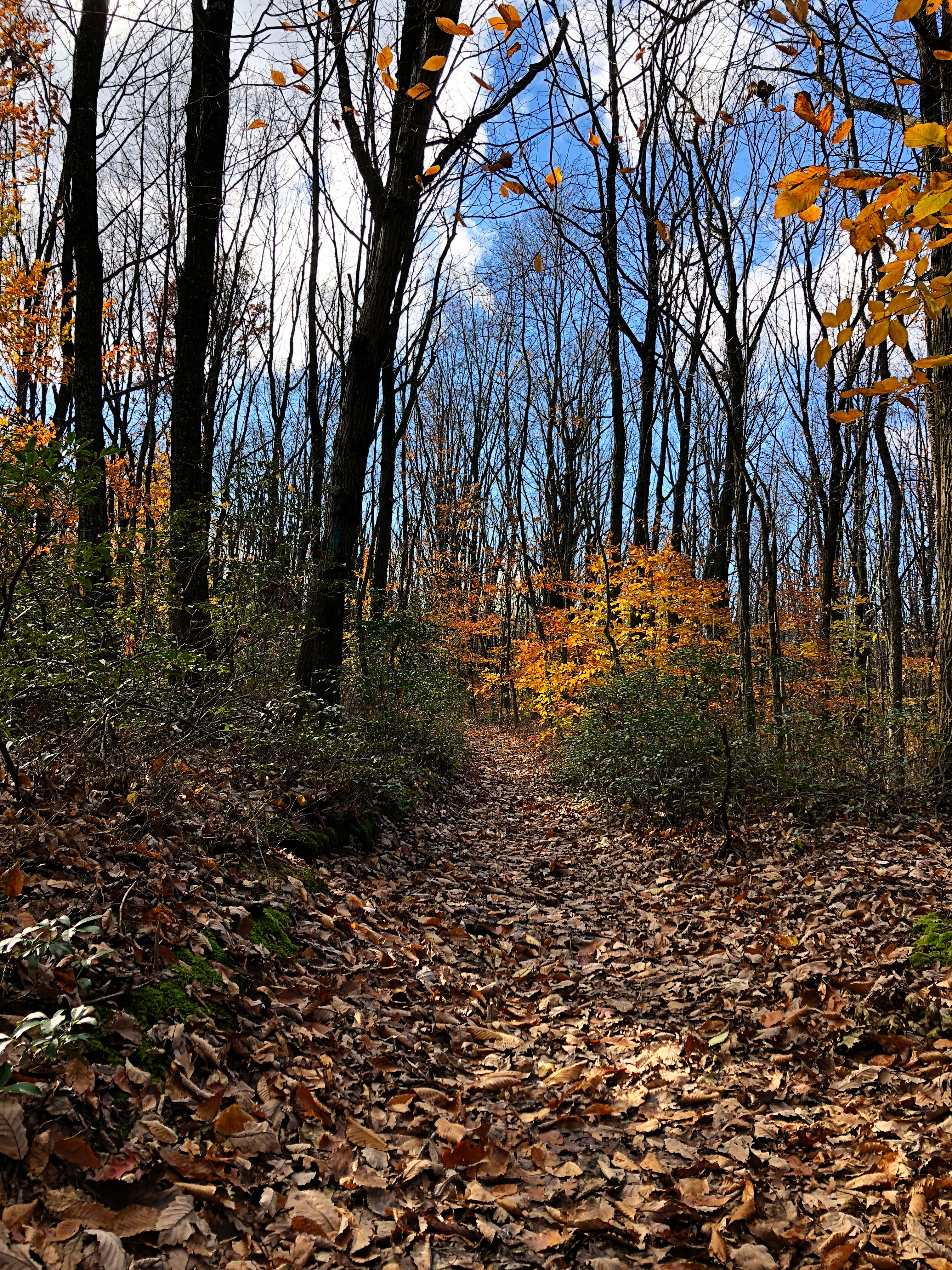
In the fall, the trail is covered in leaves, which camouflage the often rocky path underneath, so be sure to watch your step.
Overall, this is a super easy trail for beginners, children, and backpackers who want to test out a new pack or experiment with pack weight and a little easy distance. You’re likely to encounter other families and dogs, and will spot the occasional deer or boxwood turtle, but for the most part, this is a lightly trafficked trail. The Preserve does sometimes host events and training for groups such as firefighters and first responders, but you can check the Lancaster Conservancy’s website and Nature Preserve’s Facebook page ahead of time for information about events that might increase trail traffic.
Directions & Parking
A new gravel parking lot is located at the trailhead and has room for 17 cars and horse trailers. I’ve visited in all four seasons and have never seen it even close to being full.
Address — 835 Gault Rd, East Earl, PA 17519 (40.08757, -76.00221)
From Lancaster, PA (highways) — Take PA-23 E/E Chestnut Street to US 30 W. Take the exit onto US-222 W toward Ephrata/Reading. Take the US-322 exit toward Ephrata and turn right onto US-322 E/Division Highway for approximately 7.5 miles. Turn right onto PA-897 S/Springville Rd and then turn left onto Gault Road. Drive 1 mile to the Welsh Mountain Nature Preserve parking area located on the north side of Gault Road. Look for the Lancaster County Conservancy Welsh Mountain Preserve Sign.
From Lancaster, PA (scenic route) — Take PA-23 E/E Chestnut Street to US 30 E toward Coatesville. Take the PA-340/Old Philadelphia Pike exit. Turn left onto PA-340 E and follow through Bird-in-Hand and Intercourse. Turn left on New Holland Road. Turn right onto Red Well Drive. Turn right onto Diem Road. Diem Road turns left and becomes PA-897 N. Follow for 2.3 miles and turn right onto Gault Road. Destination is on the left in 1.2 miles.
Nearby Attractions & Places to Eat
We typically end our Welsh Mountain Nature Preserve hikes with a visit to nearby Kitchen Kettle Village on Old Philadelphia Pike in Intercourse. It’s a bit of a tourist trap, but there are some great food shops worth checking out. Fill up on samples or purchase beef jerky, sausages, and cheeses for your next hike at Aged & Cured, or sample jams and jellies at the Jam & Relish Kitchen. Those shops are fun year-round, but in the summer heat, you’ll want to get in line for a cone of soft-serve, home-style ice cream from Lapp Valley Farms’ Ice Cream Stand. In fall and winter, I recommend a cup of hot apple cider and a soft pretzel from Immergut Hand-Rolled Soft Pretzels.
Not into the wholesome Amish experience? Rumspringa Brewery Company is right down the road, between Intercourse and Bird-in-Hand. It has a wine gallery on the first floor and brewery and cafe with light taproom fare on the second floor.
Nearby Trails
- Green Connector Trail (2.2 miles, green blazes) – out and back, moderate
- Orange Connector Trail (1.2 miles, orange blazes) – out and back, easy
- Welsh Mountain Overlook Trail (0.4 miles, white blazes) – out and back, easy
- ADA Trail (0.5 miles) – wheelchair accessible – loop, easy
